Method

Histogram-Based Joint Boosting Classifier [st] [HistonBoost]


Submitted on 27 May. 2014 10:06 by
Giovani Bernardes Vitor (Heudiasyc Laboratory)

Running time:2.5 min
Environment:>8 cores @ 3.0 Ghz (C/C++)

Method Description:
The method is based on multi-normalized histogram with Joint Boosting algorithm to road recognition. The approach could be summarized as a
three processes executed in parallel: (i) Image Segmentation, (ii) Texton Maps and (iii) Dispton Maps. In (i) is applied a combination of pre-filters with Watershed Transform to make the superpixel. In (ii) is executed a dense feature extraction based on 2D texture image and in (iii) is performed the disparity image to get 3D information. The combination of the results
generates an unified model of road class, based on distribution of Textons and Disptons applied in Joint Boosting algorithm.
Parameters:
\lambda = 15
h = 3
Latex Bibtex:
@INPROCEEDINGS{Gio_IV14,author={Vitor, G. B. and Victorino, A. C. and Ferreira, J. V.},
booktitle={ Workshop on Benchmarking Road Terrain and Lane Detection Algorithms for In-Vehicle Application on IEEE Intelligent Vehicles Symposium (IV)},
title={Comprehensive Performance Analysis of Road Detection Algorithms Using the Common Urban Kitti-Road Benchmark},
year={2014},
keywords={Road Recognition, Computer Vision, Artificial Neural Network, Joint Boosting, Texton Map, Dispton Map, Watershed Transform}
}

Evaluation in Bird's Eye View


Benchmark MaxF AP PRE REC FPR FNR
UM_ROAD 83.68 % 72.79 % 82.01 % 85.42 % 8.54 % 14.58 %
UMM_ROAD 88.73 % 81.57 % 84.49 % 93.42 % 18.85 % 6.58 %
UU_ROAD 74.19 % 63.01 % 77.43 % 71.22 % 6.77 % 28.78 %
URBAN_ROAD 83.92 % 73.75 % 82.24 % 85.66 % 10.19 % 14.34 %
This table as LaTeX

Behavior Evaluation


Benchmark PRE-20 F1-20 HR-20 PRE-30 F1-30 HR-30 PRE-40 F1-40 HR-40
This table as LaTeX

Road/Lane Detection

The following plots show precision/recall curves for the bird's eye view evaluation.


Distance-dependent Behavior Evaluation

The following plots show the F1 score/Precision/Hitrate with respect to the longitudinal distance which has been used for evaluation.


Visualization of Results

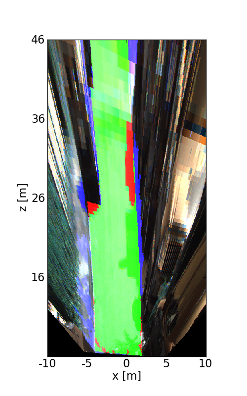
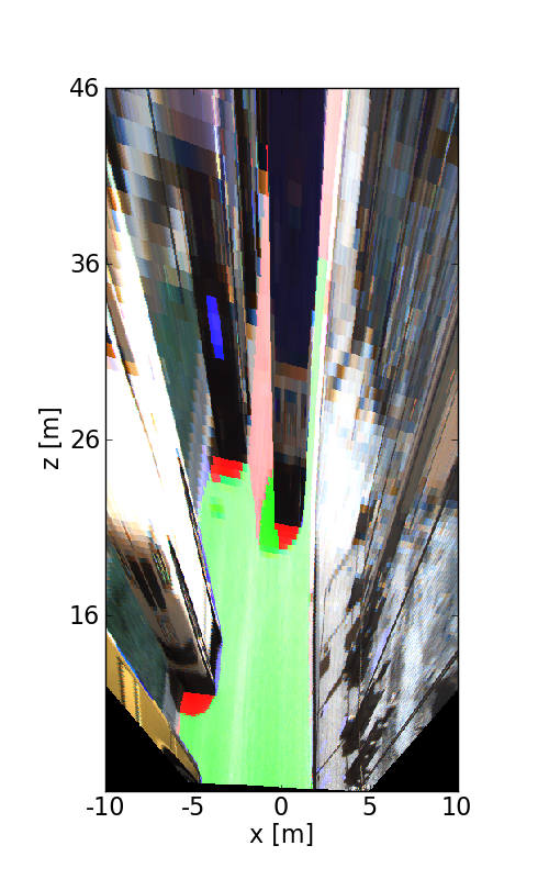
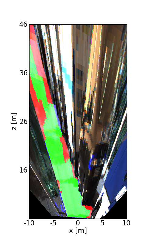
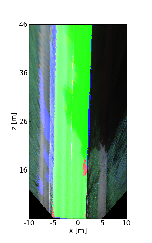
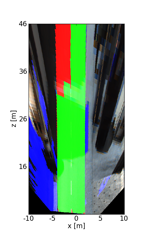
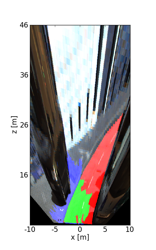
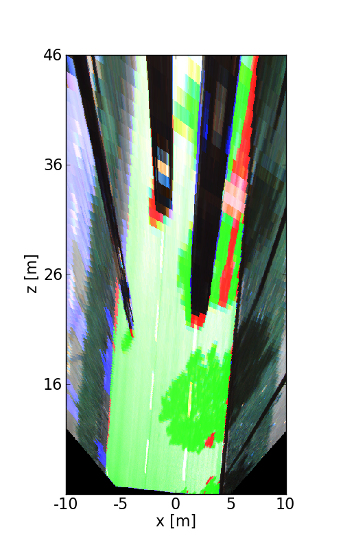
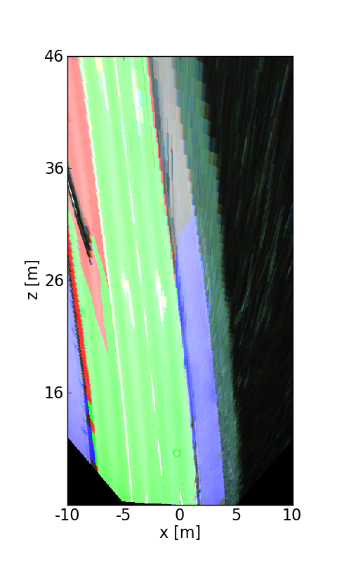
The following images illustrate the performance of the method qualitatively on a couple of test images. We first show results in the perspective image, followed by evaluation in bird's eye view. Here, red denotes false negatives, blue areas correspond to false positives and green represents true positives.


This figure as: png

This figure as: png

This figure as: png

This figure as: png

This figure as: png

This figure as: png

This figure as: png

This figure as: png

This figure as: png

This figure as: png

This figure as: png

This figure as: png

This figure as: png

This figure as: png

This figure as: png

This figure as: png

This figure as: png

This figure as: png


eXTReMe Tracker