Method

A lightweight free road space detection network [la] [LRDNet+]
http://github.com/adbkhanstd/LRDNet

Submitted on 30 May. 2022 02:28 by
Abdullah Khan (Power labs)

Running time:0.01 s
Environment:GPU @ 2.5 Ghz (Python)

Method Description:
LRDNet is a lightweight and new method that
efficiently detects free road space. The proposed
network is lightweight having only 19.5 M
parameters (approximately). To date, the LRDNet
has the least parameters and the lowest processing
time. LRDNet utilizes Lidar data for efficient
road detection. Moreover, LRDNet introduces a
novel paradigm of cascaded feature pools along
with two custom modules (Feature Transform Network
and Latent Fusion Module) that enable effective
sharing of relevant information between the two
streams of feature pools of LiDar and spatial
images.
Parameters:
All parameters are estimated automatically.
Latex Bibtex:
@article{lrdnet2022,
author={Khan, Abdullah Aman and Jie, Shao and
Yunbo, Rao and Lei, She, and Shen, Heng Tao},
journal={IEEE Transactions on Multimedia},
title={{LRDNet}: Lightweight LiDAR Aided
Cascaded Feature Pools for Free Road Space
Detection},
year={2023},
volume={},
number={},
pages={},
doi={}

Evaluation in Bird's Eye View


Benchmark MaxF AP PRE REC FPR FNR
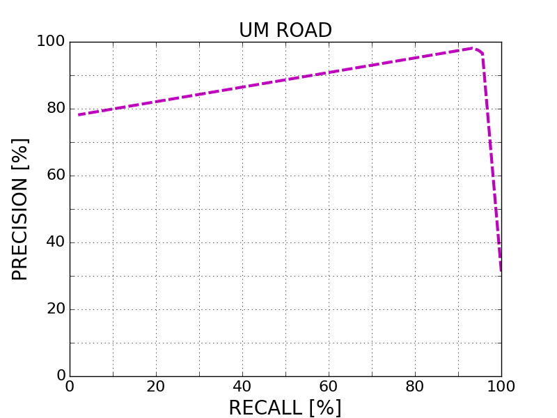
UM_ROAD 96.10 % 92.00 % 96.89 % 95.32 % 1.39 % 4.68 %
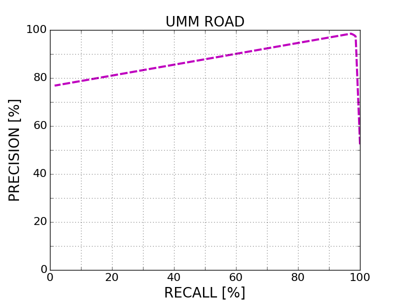
UMM_ROAD 97.98 % 94.28 % 97.67 % 98.29 % 2.58 % 1.71 %
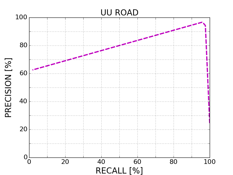
UU_ROAD 96.18 % 90.03 % 95.94 % 96.42 % 1.33 % 3.58 %
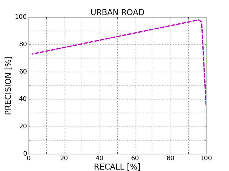
URBAN_ROAD 96.95 % 92.22 % 96.88 % 97.02 % 1.72 % 2.98 %
This table as LaTeX

Behavior Evaluation


Benchmark PRE-20 F1-20 HR-20 PRE-30 F1-30 HR-30 PRE-40 F1-40 HR-40
This table as LaTeX

Road/Lane Detection

The following plots show precision/recall curves for the bird's eye view evaluation.


This figure as: png eps pdf

This figure as: png eps pdf

This figure as: png eps pdf

This figure as: png eps pdf

Distance-dependent Behavior Evaluation

The following plots show the F1 score/Precision/Hitrate with respect to the longitudinal distance which has been used for evaluation.


Visualization of Results

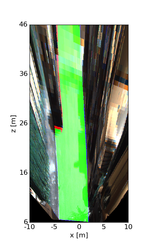
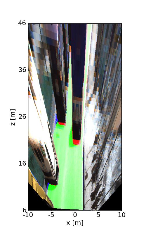
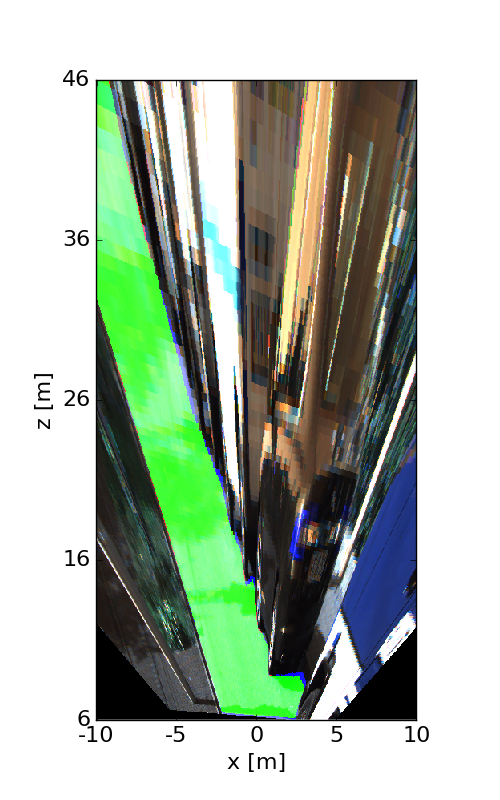
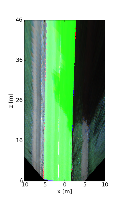
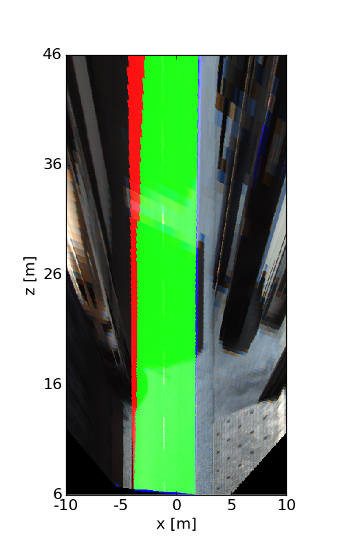
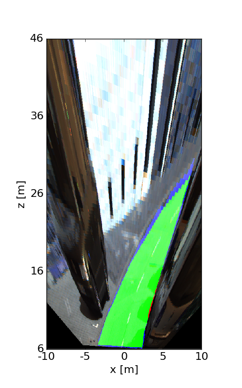
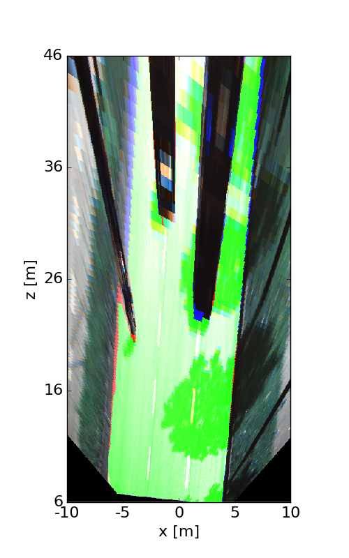
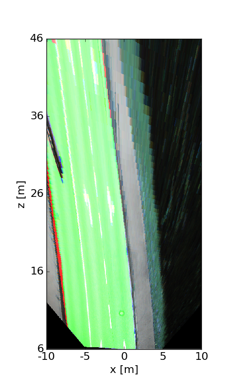
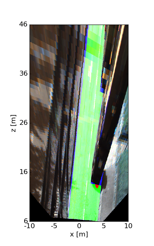
The following images illustrate the performance of the method qualitatively on a couple of test images. We first show results in the perspective image, followed by evaluation in bird's eye view. Here, red denotes false negatives, blue areas correspond to false positives and green represents true positives.


This figure as: png

This figure as: png

This figure as: png

This figure as: png

This figure as: png

This figure as: png

This figure as: png

This figure as: png

This figure as: png

This figure as: png

This figure as: png

This figure as: png

This figure as: png

This figure as: png

This figure as: png

This figure as: png

This figure as: png

This figure as: png


eXTReMe Tracker